Property Assessment
Customized Geospatial workflow
Property assessment
Canopy height > 3 m
- Canopy > 3 m
- 26.7%
- Area > 3 m
- 8.1 ha

We work with science and geospatial teams to turn project-specific methods into repeatable workflows, from a first prototype to processing across a portfolio.
Explore geospatial workflowsCustom-built around your project’s data, methods and criteria.
Customized Geospatial workflow
Canopy height > 3 m
Your methods and data. Workflows we build together.

Work with us to turn your science and geospatial expertise into a working prototype. Define the inputs, processing steps and outputs together, test on representative sites, and refine the method with your team.
How we work with your team
Turn the agreed method into repeatable workflows and processing pipelines. Consolidate geospatial layers, feed land eligibility flows, or prepare inputs for carbon monitoring—across individual sites or a whole portfolio.
Explore Living Carbon
Bring outputs back into the maps and records your team uses. Add information layers, compare basemaps to investigate land change, and connect monitoring results to the people making decisions.
Explore data layersReady-made analyses for any property boundary: forest history, land types, canopy height, open land and terrain.

Tree cover in 2000, loss from 2001 to 2024, and gain, for one property.
Read more
Six kinds of land in 2020 across the property, with other land outlined for a field visit.
Read more

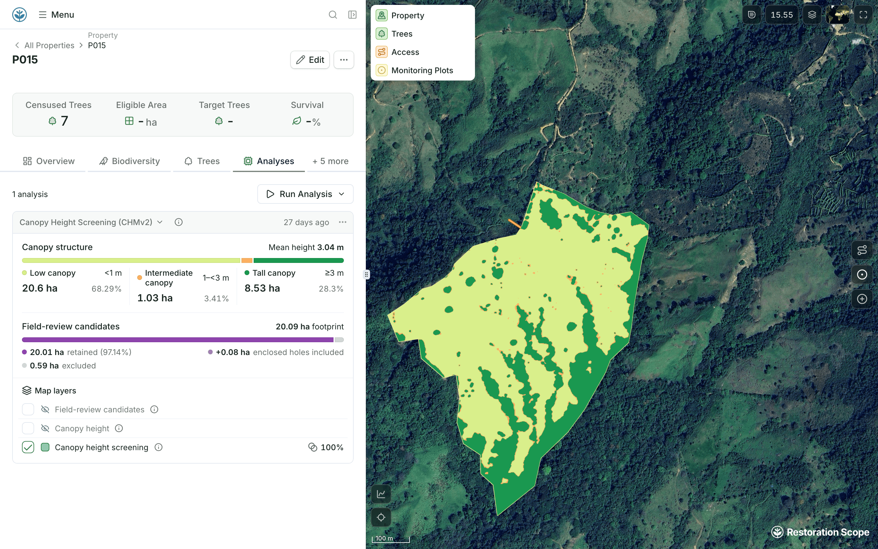
Canopy height at about 1.2 m, grouped into low, intermediate and tall, with low canopy outlined for a visit.
Read more
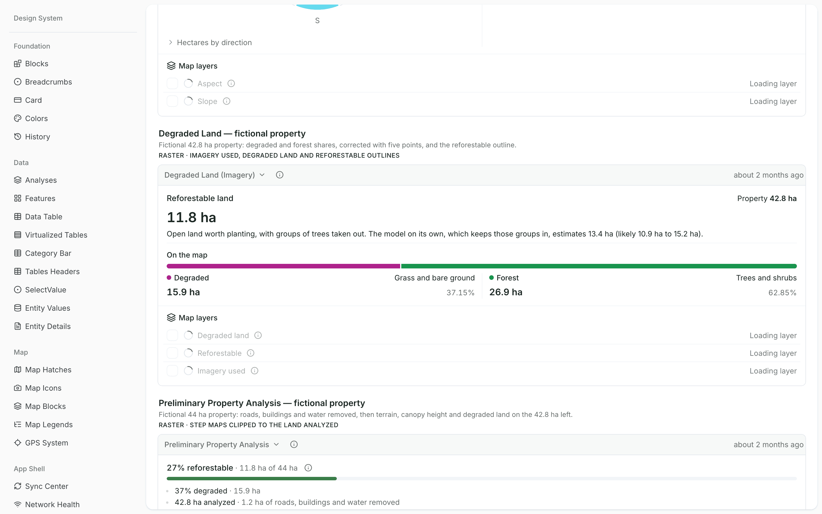
Grass and bare ground mapped against trees and shrubs on recent imagery, corrected with your own points.
PilotRead more
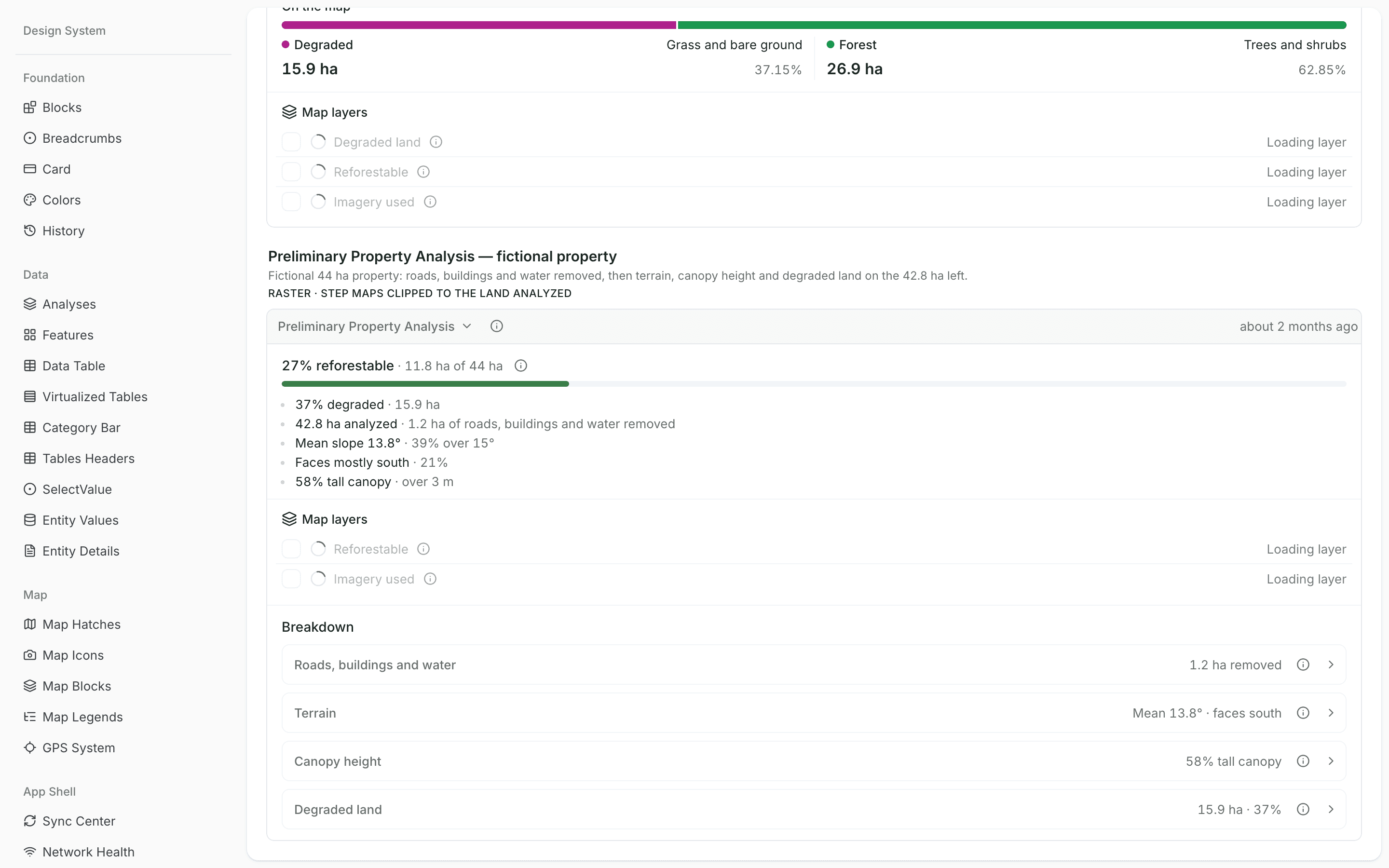
Roads, buildings and water cut out, then terrain, canopy height and degraded land read on the rest.
PilotRead more
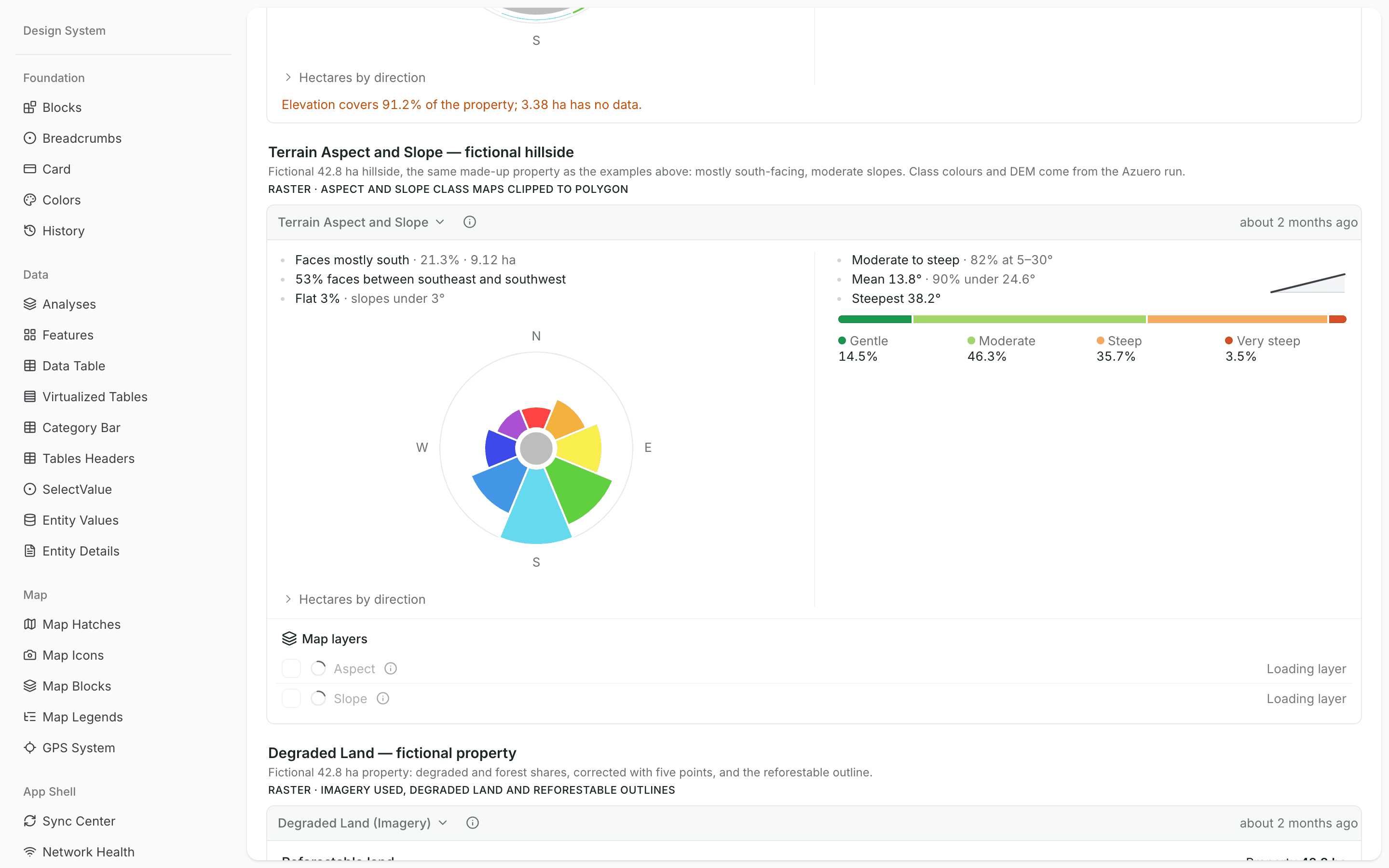
Area facing each compass direction, flat ground and four slope classes, from a 30 m terrain model.
Read more56 datasets available to process. Bring satellite imagery, land cover, forest, water and terrain data into your team’s workflows.
Explore Data LayersSix ready-made analyses run on any property boundary: forest cover, land structure, canopy height, degraded land, a preliminary property analysis, and terrain aspect and slope.
Yes. Workflows can screen land eligibility, assess a property or detect change, and prepare inputs for carbon monitoring, across one site or a whole portfolio.
Yes. We prototype your team’s method with you, test it on representative sites, then run it as a repeatable workflow across the project.
A record being created or updated, or a run on demand. Results come back as updated fields and map layers on the records your team uses.
Bring in the spreadsheets, field forms and maps you already use, and see every site in one place.