Getting VM0047 Tree and Plot Records Ready for Verification
Get VM0047 tree and plot records ready for your VVB. Freeze IDs, reconcile the census, close out mortality and check boundary files before verification.
To get VM0047 tree and plot records ready for verification, work back from what your validation and verification body (VVB) will trace: agree the exports and document list first, then freeze tree and plot IDs, reconcile the census count, close out mortality and replanting, record who measured what, attach photos and GPS, and check boundary files. Start before you book the VVB. Verra publishes no fixed timeline, and findings that aren't resolved can add review rounds.
Where Restoration Scope fits: we keep the census and plot records VM0047 asks for. Each tree gets its ID, species, GPS point and photos, recorded offline in Restoration Scope Field; every inspection stays on its record; and tables export as CSV for your VVB. We don't supply the stocking index or calculate credits; a stocking-index provider and your methodology expert do. More on where software fits.
This guide follows VM0047 version 1.1 and VCS version 5, in our own words. For what to record in the first place, read VM0047 field data. Checked October 23, 2026.
How long does verification take?
There is no standard answer. Neither Verra nor the VVBs we checked publish a typical duration. What the documents do fix:
- Notice. The VVB tells Verra at least 15 business days before its opening meeting.
- Site visit. Required at the first verification after validation, and later for baseline reassessments and some project description deviations. Otherwise the VVB decides from its own risk assessment.
- Verra's review. After the VVB reports, Verra may raise up to three review rounds, and can return the request if the VVB doesn't answer within 90 days. Its review targets are in the Verra Project Tracker.
In April 2026, Verra reported averages of 127 to 169 calendar days from its first review findings to approval, depending on the review report format. The part you control is how many findings your records produce.
Sources: VCS Standard v5.0,
Registration and Issuance Process v5.0,
Notice of Validation/Verification Services form,
Verra's April 2026 stakeholder update.
Before you book: agree the exports and document list
Ask your VVB early which files it wants and in what format: the tree list, the plot database, the sample draw, boundary files and photos. Agree how a row in an export points back to a record in the field.
Two VCS version 5 changes apply to requests submitted from January 1, 2027: project documents go through the Verra Project Hub wherever a digital version of the methodology exists, and every verification includes an updated geolocation file. Check Verra's effective dates for your project.
Freeze tree and plot IDs
Every census tree and every plot keeps one ID from year zero onward. A renamed ID breaks the line between the tree counted at planting and the tree measured now.
If IDs did change, don't overwrite them. Keep a table of old and new IDs, so the VVB can follow any record back to its first count.
Reconcile the census count
For census-based projects, the number of planted trees, N, multiplies everything else, so check it before anyone else does:
- Duplicates. The same tree under two IDs, or two GPS points closer together than your GPS accuracy. VM0047 asks for trees at least that far apart when GPS identifies them.
- Trees not found. VM0047 assumes a planting unit that can't be located during a monitoring event has died. Find them now, while a field team can still look.
- Trees that don't count. Trees that were there before the project don't count toward N or the limit of 50 planting units per hectare.
- Totals that disagree. Compare the census list with planting records farm by farm. Every gap needs an explanation the VVB can read.
Close out mortality and replanting
For each monitoring event, the sample should show which trees were live or dead, and how the sample was drawn from the census list. Mortality is monitored every five years or more often.
Replanting needs its own record: which dead tree it replaces, where and when. Live project trees still have to stay within 50 per hectare. Area-based projects close out their plots the same way: biomass plots are measured every five years or more often, and stocking-index values at least once a year.
Show who measured what, when and with which device
The monitoring plan names roles, responsibilities and the chain of custody for the data. The records are where a VVB sees it happen, so keep for each tree or plot who measured it, on what date, with which device, and who checked the data afterwards.
Keep your quality checks too. Re-measurements, corrections and the reason for each change are evidence that the QA/QC in your monitoring plan happened.
Attach photos and GPS to their records
A photo in a shared folder proves little. A photo attached to tree T-0412, with its location and date, lets the VVB check the record without asking.
When a field team attaches a photo in Restoration Scope Field, the app reads the photo's location from its EXIF data, falls back to another location it can trust when the photo has none, and records where the location came from. See field photos missing GPS for why photos lose their location.
Check boundary files against Verra's rules
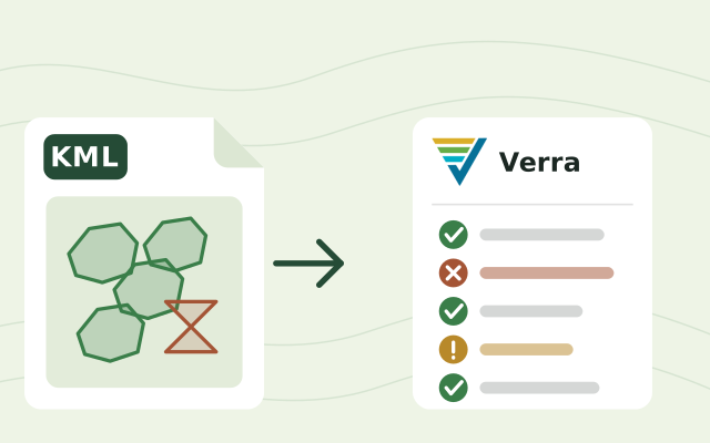
Verra's geolocation file requirements v5.0 ask for a KML or KMZ file in WGS84, with each project instance named, dated and placed in the right folder, and no overlapping, duplicate or self-crossing shapes. The VVB checks the file before it reaches Verra. Verra suggests checking it in QGIS, ArcGIS or GDAL.
To check it in your browser, drop the file into our free  Verra geolocation file checker. It marks overlaps and self-crossing outlines on the map for you to fix at the source, and rebuilds the file with the expected names, folders, centroids and areas. It's independent of Verra, so your VVB still reviews the file.
Prepare the exports the VVB reviews
Each figure in the monitoring report should trace back to rows:
- Tree list: ID, cohort, species, location and status at each monitoring event.
- Plot database: ID, location, size and layout, with control plots and their matched project plot for area-based projects.
- Sample: how it was drawn, which trees or plots it contains, and their measurements.
- Changes: replanting, removed records and ID changes, each with a date and a reason.
What verifiers send back
VVBs raise clarification requests (CLs) when they need more information, and corrective action requests (CARs) for a material discrepancy or non-conformance. Every CL and CAR must be resolved before a positive verification statement. Verra's verification report template also lists forward action requests (FARs), issues to address by the next verification. Verification aims for reasonable assurance, with a materiality threshold of 1% for large projects and 5% for the rest.
Records can turn into findings when a total can't be traced to rows, an ID can't be followed back to the census, a boundary file has overlaps, or a tree nobody could find is still counted as alive. Each of the checks above closes one of those doors.
Where software fits
A census project across many farms can hold tens of thousands of trees that each have to be found again years later. A spreadsheet can hold the list. Keeping IDs, photos, GPS points, mortality checks and replanting consistent across seasons and field teams is the hard part.
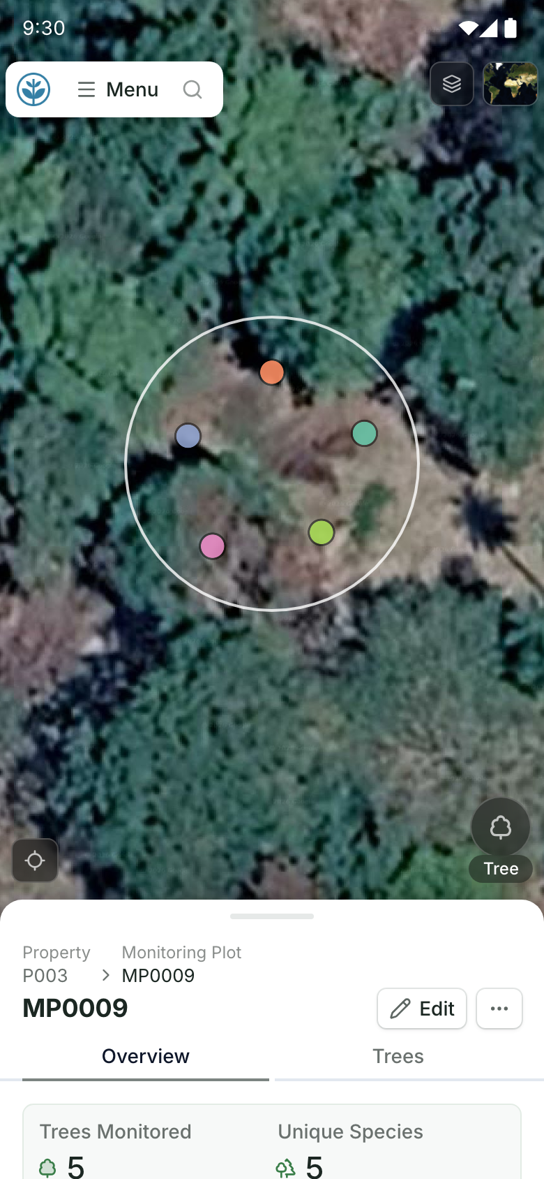
Restoration Scope gives field teams offline capture of tree and plot records with GPS and photos, keeps the history of inspections and field updates on each record, and exports tables as CSV for your VVB. It doesn't calculate credits or replace your methodology expert. See Restoration Scope for carbon projects.
A monitoring plot on a phone.
The plot on the map with each tree recorded inside it, and the plot's record below. Demo project: names and numbers are made up.
More guides: what VM0047 asks you to record, finding bad records across thousands of smallholder plots and compare carbon standards for nature projects.
Questions about VM0047 verification
How long does VM0047 verification take?
Neither Verra nor the VVBs we checked publish a fixed duration. The VVB must tell Verra at least 15 business days before its opening meeting, and in April 2026 Verra reported averages of 127 to 169 calendar days from its first review findings to approval. Findings that aren't resolved can lead to further review rounds.
Does the VVB visit the site at every verification?
Not always. Under VCS Standard v5.0, a site visit is required at the first verification after validation, and at some later ones such as baseline reassessments. Otherwise the VVB decides from its own risk assessment and documents why.
What happens to census trees we can't find?
VM0047 assumes a planting unit that can't be located during a monitoring event has died. Stable IDs, good locations and physical markers keep living trees countable.
What is the difference between a CAR and a CL?
A clarification request (CL) asks for more information. A corrective action request (CAR) records a material discrepancy or non-conformance. Both must be resolved before the VVB issues a positive verification statement.
Do I need a new geolocation file at every verification?
Today, when project location information changes: instances or geodata added, removed or reshaped, earlier information corrected or improved, or land-rights areas changed. Verra's VCS version 5 updates require an updated file at every verification for requests submitted from January 1, 2027.
Another question? Email us or book a call.